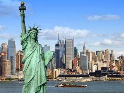
May 24 (CNN) — New York City is sinking under the collective weight of all of its buildings, a new study has found.
This gradual process could spell trouble for a city around which the sea level has been rising more than twice as fast as the global rate — and is projected to rise between 8 inches and 30 inches by 2050.
Subscribe to our Telegram channel for the latest updates from around the world
What’s more, scientists expect more frequent and extreme rainfall events such as nor’easters and hurricanes due to the human-fueled climate crisis.
“We’re a ways off from the ocean simply moving in,” said lead study author Tom Parsons, a research geophysicist at the US Geological Survey. “But we’ve had a couple of major hurricane events with Sandy and Ida in New York where heavy rainfall caused inundation in the city, and some of the effects of urbanization have allowed water to come in.”
The paper, published in the journal Earth’s Future, aims to show how high-rise buildings in coastal, riverfront or lakefront areas could contribute to future flood risk and that measures should be taken to mitigate the potentially hazardous impacts.
Sinking city risks — and a mystery
The researchers calculated the mass of the 1,084,954 buildings that existed across the five boroughs of New York City at the time, reaching the conclusion that they weighed about 1.68 trillion pounds (762 billion kilograms) — equivalent to roughly 1.9 million fully loaded Boeing 747-400s.
The study team then used simulations to calculate the effects of that weight on the ground, comparing that with satellite data showing actual surface geology. That analysis revealed the rate at which the city is sinking: “The average is about 1 to 2 millimeters a year, with some areas of greater subsidence that are up to about 4½ millimeters a year,” Parsons said.
Subsidence is the technical term for the sinking or settling of Earth’s surface due to natural or artificial causes. A September 2022 study found that 44 of the 48 most populous coastal cities have areas that are sinking faster than sea levels are rising. This latest study’s novel approach is to take into account specifically the weight of New York City’s buildings and how they are contributing to the subsidence of the land beneath them.
However, not all of the sinking is due to the buildings. “We could see some correspondence where there’s construction on very soft soils and artificial fill,” Parsons said. “Other places, we see subsidence that’s difficult to explain. And there’s a lot of different causes of it, such as post glacial relaxation that happened after the last ice age, or groundwater pumping.”
Some areas of lower Manhattan, Brooklyn and Queens are among those that are sinking at a faster than average rate, according to the study.
“Some of that seems to correspond with construction projects going on,” Parsons said. “But we also see subsidence on the north end of Staten Island that I can’t figure out an explanation for, and I’ve looked into all kinds of different things — so that still remains a mystery.”
Mitigating risk around sinking cities
Subsidence can pose an even earlier flooding threat than sea level rise, the research suggests, and not just in New York City. “It’s a global issue. My coauthors from the University of Rhode Island looked at 99 cities around the world, not only coastal but inland as well, and the vast majority of them have subsidence issues,” said Parsons, citing the case of Jakarta, which is sinking so fast that the Indonesian government is planning to build a new capital city elsewhere.
“We know that global sea levels are rising and shorelines are changing, and that it is critical to understanding the impact of human activities, such as greenhouse gas emissions, on our warming world,” said geophysicist Sophie Coulson, a postdoctoral fellow at Los Alamos National Laboratory who was not involved in the study. “This research takes a look at an important human factor that has only recently come into focus — the effect of urban building loads on coastal land subsidence.”
The authors, she added, use a clever combination of computer modeling, satellite measurements and GPS data to estimate the short- and long-term sinking rates of different areas of the city and identify the areas most at risk.
“New York City is among the most densely populated coastal areas in the world, with a large portion of its critical infrastructure constructed in low-lying coastal areas,” she said.
“Understanding how and why the landscape is changing, and identifying areas most vulnerable to flooding is essential for making the right preparations to mitigate future sea level rise.”
For similar articles, join our Telegram channel for the latest updates. – click here


